SAL Engineering designs and manufactures integrated systems for aerial thermal investigations of structures, electricity production plants, industrial plants, public buildings. The system consists of a remotely piloted aerial vehicle, with a stabilized flight attitude and planned by waypoints thanks to a ground control station, and a thermal camera with a bolometric sensor. Despite the miniaturization of the sensors, the high sensitivity allows obtaining high precision thermal measurements.
The thermal targets (TT K100 series) were created in order to identify specific objects and to georeference the model thanks to a GNSS survey and the recognition of the same on images and videos.
It is possible to observe real-time images of the survey area on the screen of the Ground Control Station, which allows to concentrate on the zones characterized by thermal anomalies.
Thermal investigations are very useful in scenarios in which physical phenomena that affect the surface temperature of the structures are investigated. For example, this kind of investigation is of primary importance in order to obtain information about the production processes or the performance analysis of an industrial plant.
A thermal survey on structures and infrastructures makes it possible to identify structural defects, locate points of thermal dispersion or areas with higher humidity or less sun exposure. In restoration work, it is possible to identify reticular structures under the plaster. It is possible to check infiltrations on roofs and chimneys. In industrial plants it is possible to control, in a non-invasive way, the production chain or elements and areas at risk of overheating without stopping production.
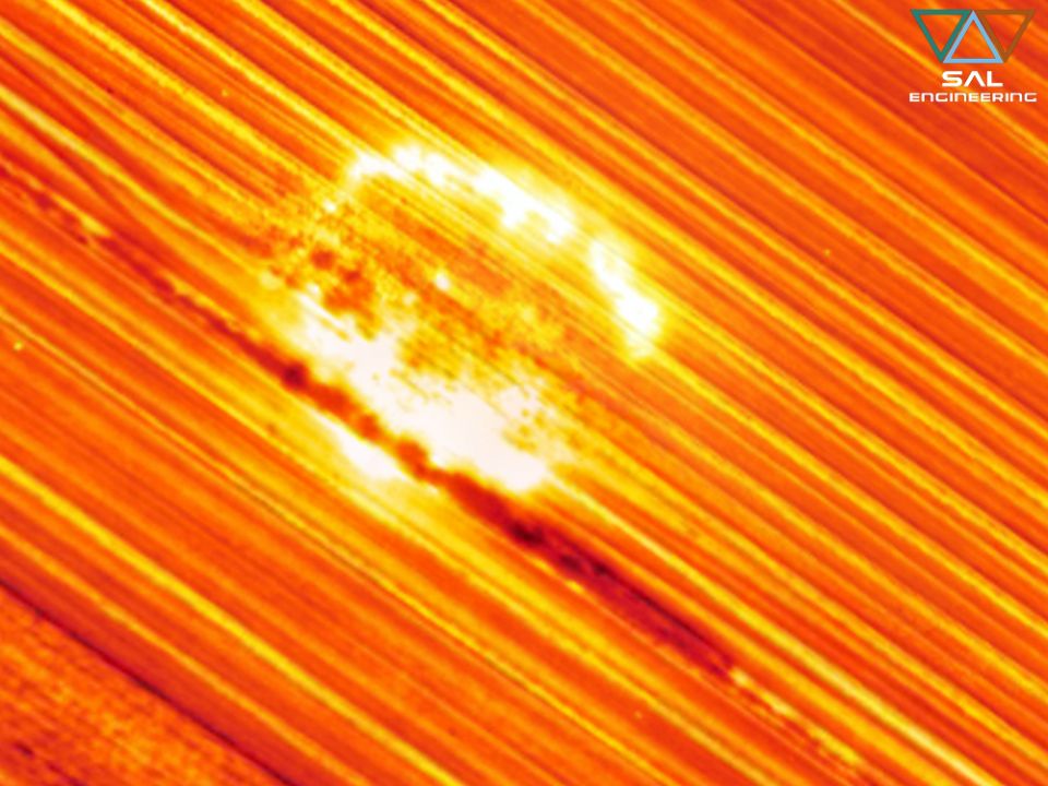
In the field of monitoring renewable energy sources, the location of thermal anomalies on wind turbines and photovoltaic modules has been successfully tested.
The surveys are non-invasive and can be carried out in most environmental situations, while data are processed quickly. The aerial survey is coupled to a ground GNSS survey that allows to georeference the 3D model and the resulting products. Data processing is done with specific software while the creation of 3D models is made possible thanks to the photogrammetric process, using the Structure from Motion and Bundle Adjustment algorithms. The results of the thermographic survey are georeferenced thermal video and integrated into GIS systems with the possibility of creating a geodatabase, thermal photos, graphs, statistics and indices for the specific analysis of the structures. SAL Engineering provides a final report with all the survey results and the procedures performed.
“Thermo UAV Tracker" is a software that is capable of reproducing georeferenced thermographic videos from which it is possible to analyze absolute temperature data with the same functions and interactive possibilities as "Video UAV Tracker". The use of "Thermo UAV Tracker" is particularly useful in the monitoring of photovoltaic systems thanks to the possibility to identify and georefer thermal anomalies in a short time, thus allowing an analysis of the general state of photovoltaic panels and of all the hot parts of large plants.
Contact us for more information on Having Our activities, our products and services
Click hereSAL Engineering designs and manufactures integrated remote sensing systems, offers services of data acquisition, processing and editing of geo-referenced mapping products. Remote sensing techniques...
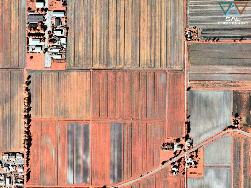
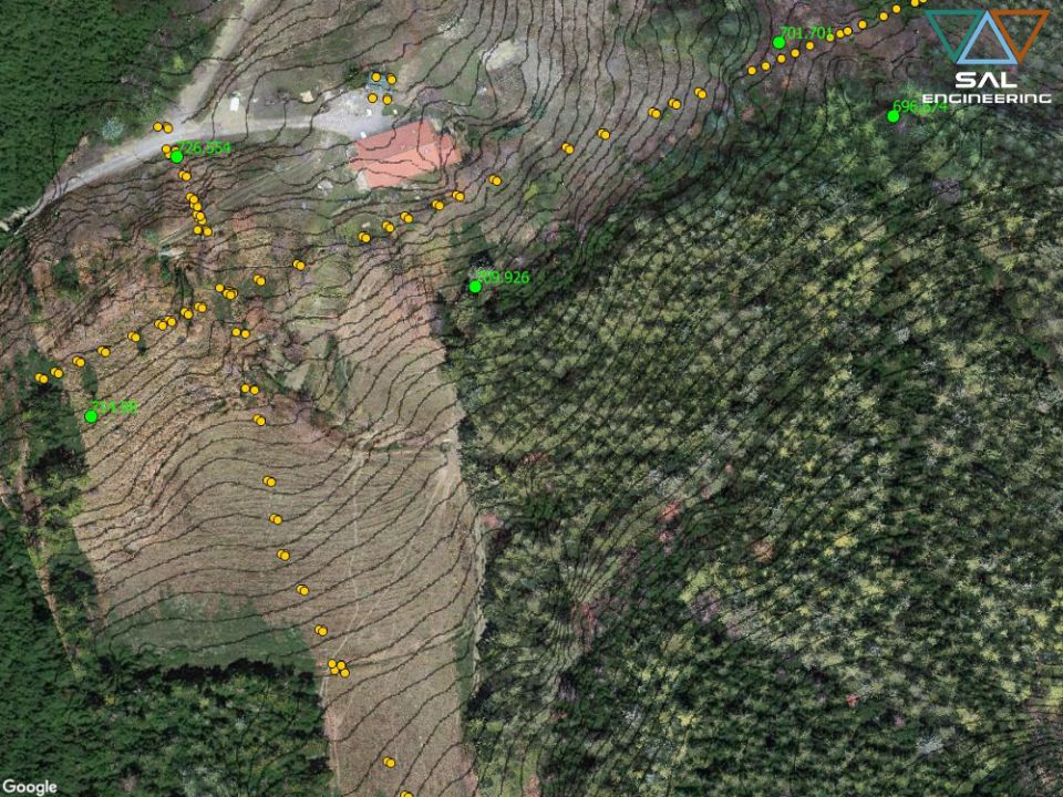
SAL Engineering designs and manufactures integrated systems for photogrammetric surveys of land in the field of hydrogeological instability, protection of the territory, hydrogeological prevention, pl...
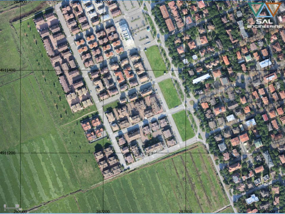
SAL Engineering designs and manufactures integrated systems for photogrammetric surveys aimed at creating 3D models with high precision and accuracy of buildings, industrial plants, quarries, dumps, c...
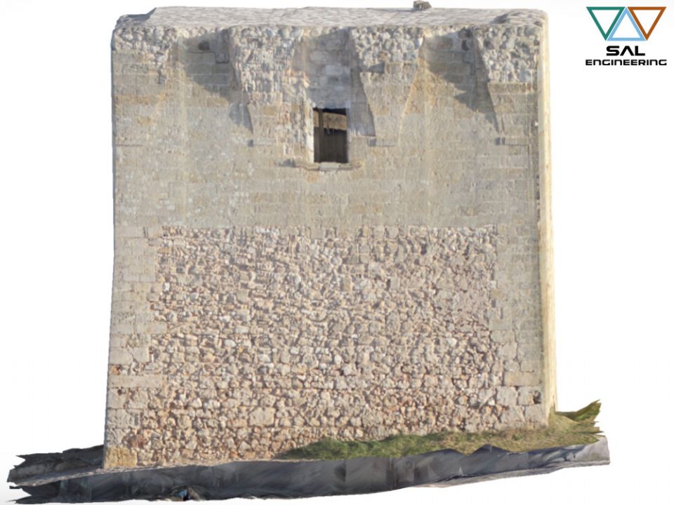
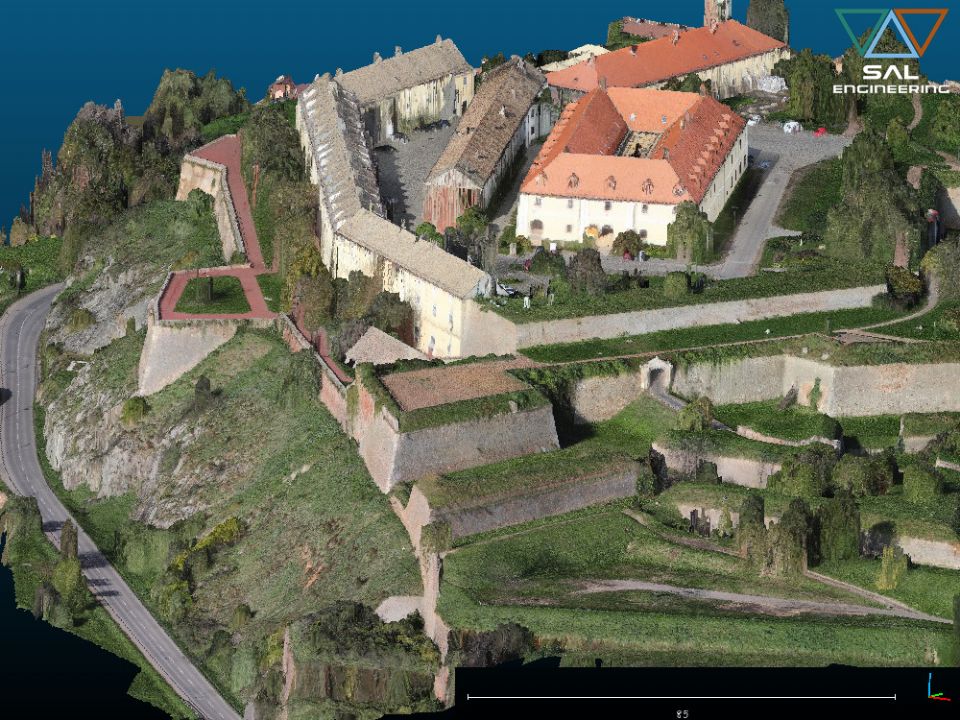
SAL Engineering provides aerial and terrestrial photogrammetric surveys aimed at the three-dimensional reconstruction of terrains, structures, pylons, towers, archaeological sites, antennas, ruins, ro...
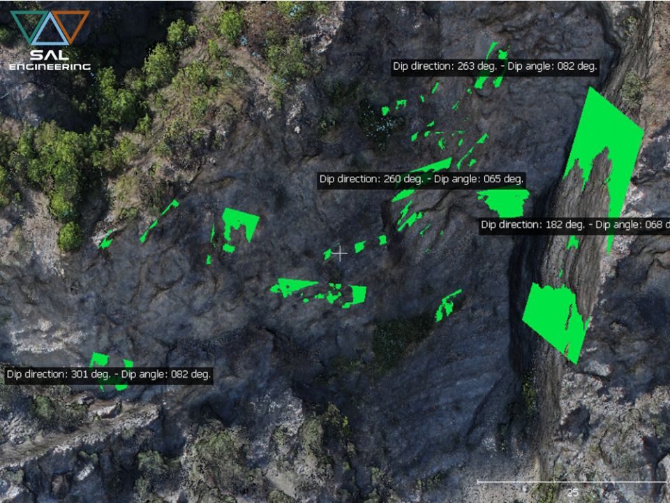
SAL Engineering has developed a method of digital analysis and survey of the discontinuities of the cliffs and rock formations directly on the point cloud obtained through photogrammetric survey, repl...
SAL Engineering has professional instruments such as dual frequency satellite receivers, high performance GNSS antennas, high precision total stations, high precision levels and high skills for the re...
SAL Engineering designs and produces integrated systems for thermographic surveys aimed at mapping the surface temperature of terrains and any other surface. The system consists of a remotely piloted ...
SAL Engineering designs and manufactures video acquisition systems to conduct inspections, for research and rescue activities, to plan photogrammetric surveys, to have visibility of otherwise inaccess...
2015 - 2026 © SAL Engineering S.r.l.