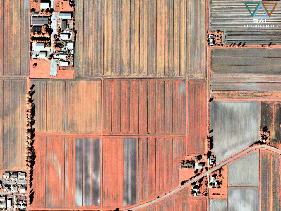
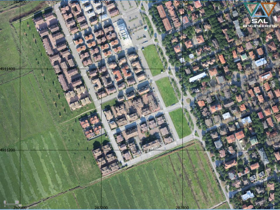
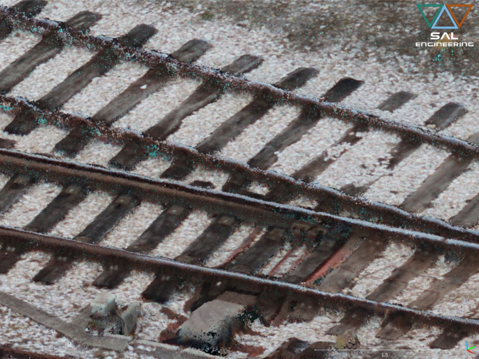
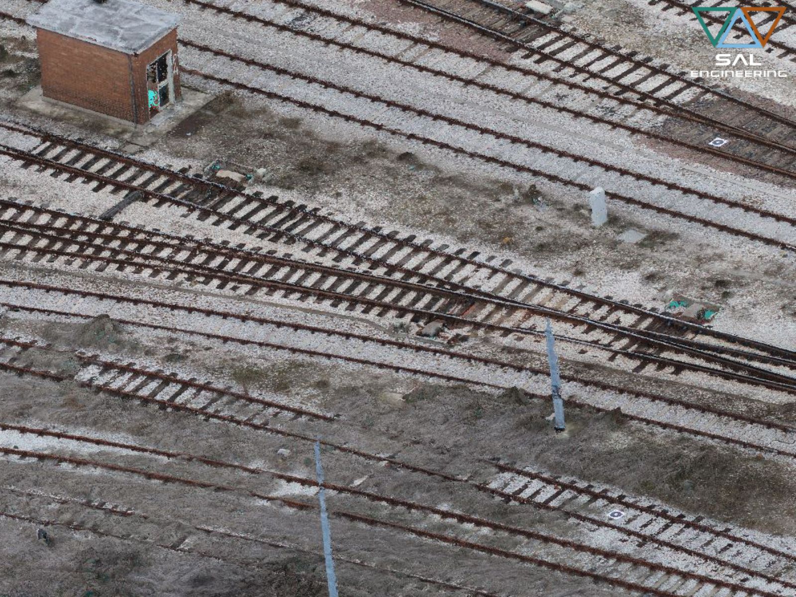
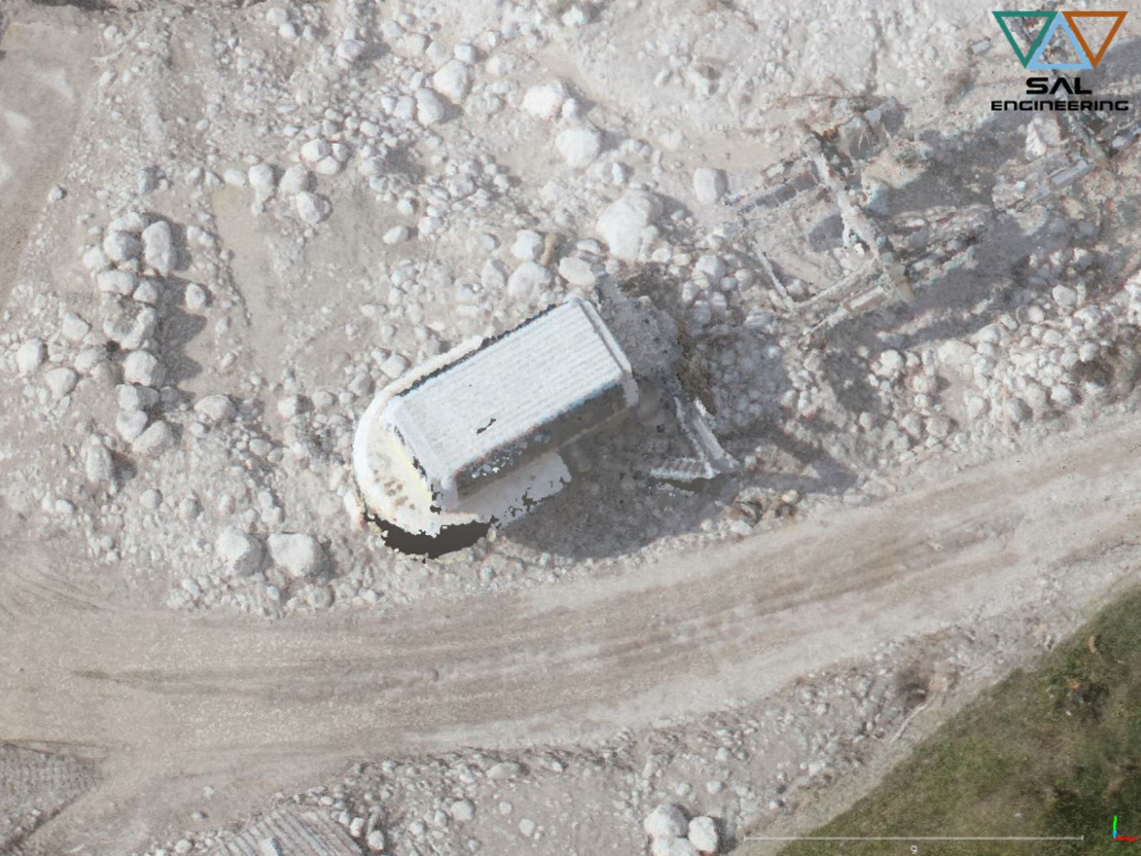
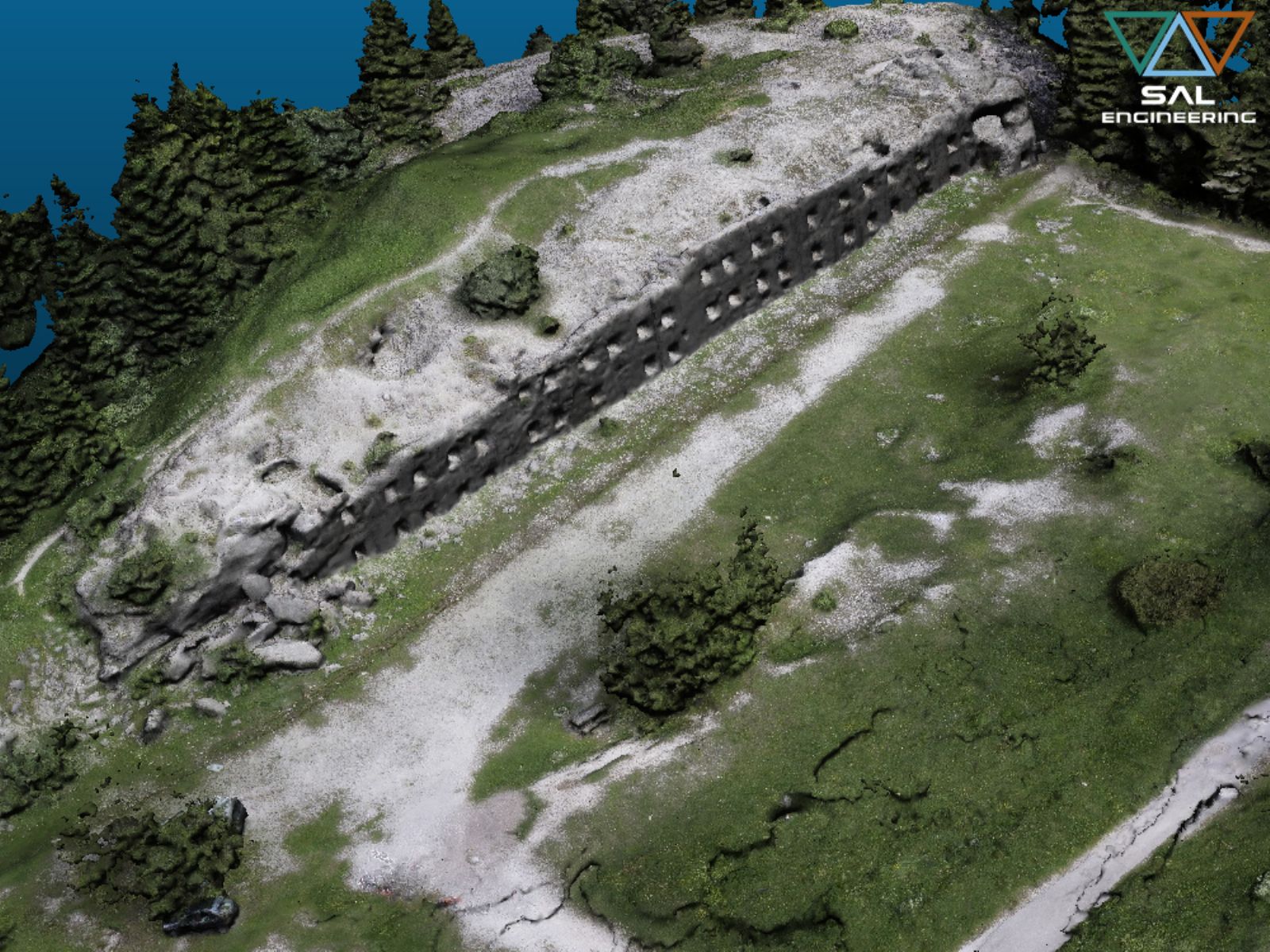
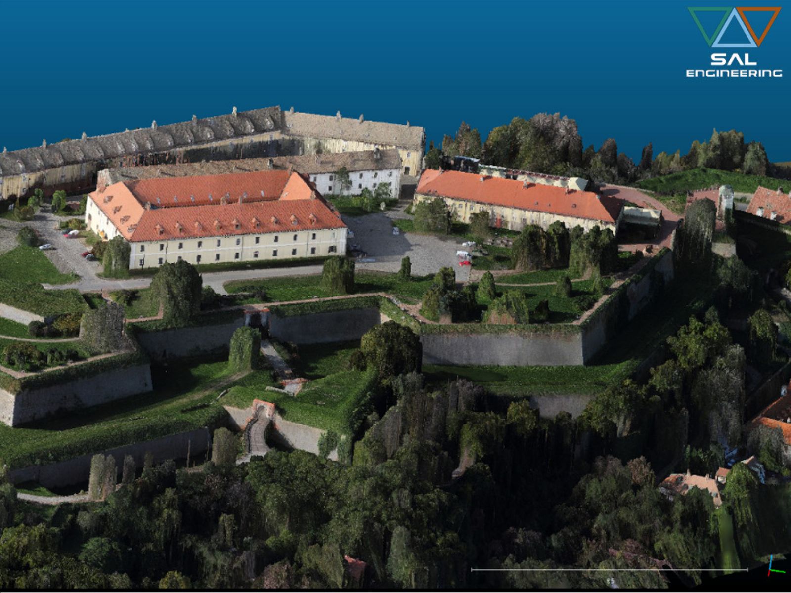
SAL Engineering designs and manufactures integrated systems for photogrammetric surveys aimed at creating 3D models with high precision and accuracy of buildings, industrial plants, quarries, dumps, construction sites, bridges, road, highway and railway infrastructures, historic buildings.
The survey system consists of a remote control aerial, gimbal for stabilized image acquisition, and photogrammetric sensor. The integration of inertial platform and GNSS positioning system allows to carry out scheduled and stabilized flights via waypoints; an additional GPS allows the georeferencing of each photo, in order to obtain a more rapid and accurate 3D reconstruction.
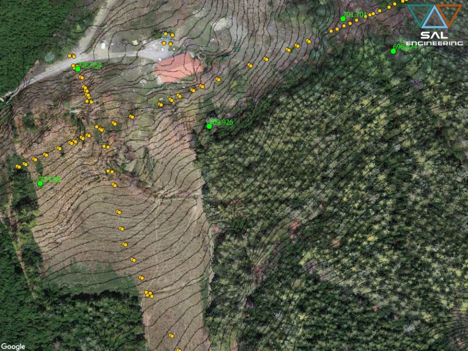
The acquisition of geo-referenced images is complementary to a topographic survey on the ground; various GCP (ground control point), visible in the photos, are measured by a GNSS system or a total station with high precision, in order to optimize the bundle adjustment process, georeference the 3D model and insert it into a geodetic reference system.
In the case where a portion of the relief area is not suitable for the photogrammetric survey, a topographic survey is performed and then the data are integrated in the point cloud in order to create a complete model of the entire area.
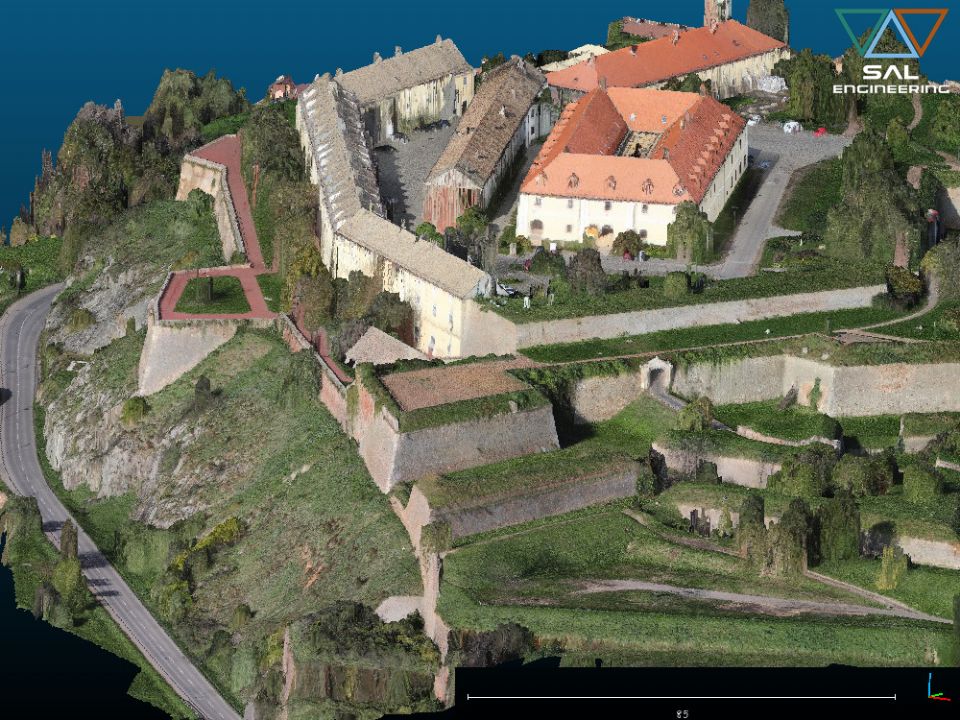
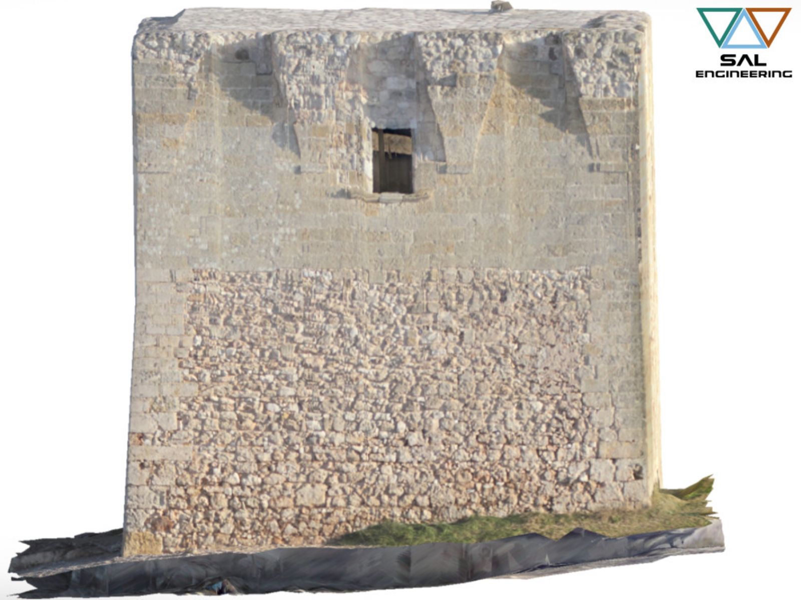
The images and GNSS data are processed with the most advanced photogrammetric software using structure from motion and bundle adjustment algorithms for the creation of a high density point cloud (in which the RGB data is also present), from which it is possible to extract different products.
These products are nadiral or perspective orthophotos, sections, vector data for cartography, vector planes of the facade or certain components of the structure, 3D model for BIM, virtual reality and augmented reality, volume and bulk data, architectural rendering. The research and development section, awarded with various publications in trade magazines, guarantees the high standards of precision and accuracy. These products can be used in GIS, CAD and BIM environments. A flexible and non-invasive procedure allows a wide range of applications in the field of building design, infrastructure design and protection and conservation of archaeological and architectural heritage.
Contact us for more information on Having Our activities, our products and services
Click hereSAL Engineering designs and manufactures integrated remote sensing systems, offers services of data acquisition, processing and editing of geo-referenced mapping products. Remote sensing techniques...
SAL Engineering designs and manufactures integrated systems for photogrammetric surveys of land in the field of hydrogeological instability, protection of the territory, hydrogeological prevention, pl...
SAL Engineering provides aerial and terrestrial photogrammetric surveys aimed at the three-dimensional reconstruction of terrains, structures, pylons, towers, archaeological sites, antennas, ruins, ro...
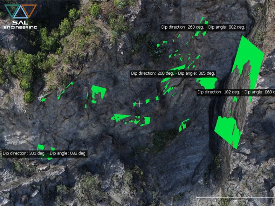
SAL Engineering has developed a method of digital analysis and survey of the discontinuities of the cliffs and rock formations directly on the point cloud obtained through photogrammetric survey, repl...
SAL Engineering has professional instruments such as dual frequency satellite receivers, high performance GNSS antennas, high precision total stations, high precision levels and high skills for the re...
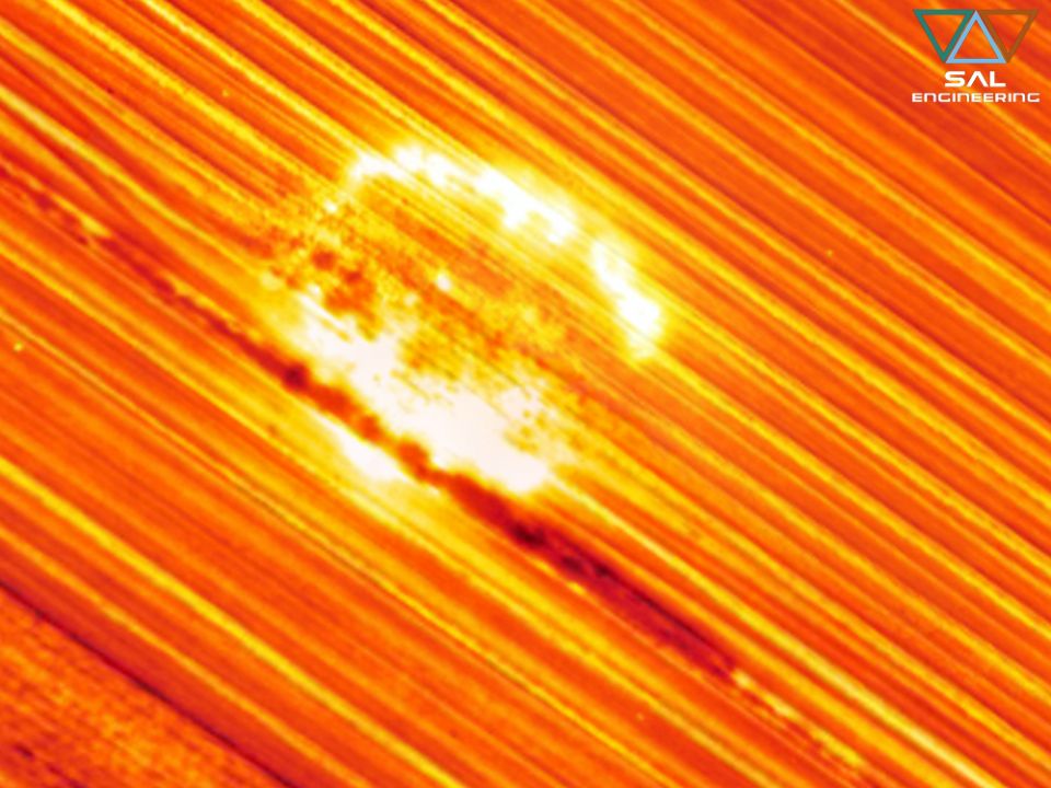
SAL Engineering designs and produces integrated systems for thermographic surveys aimed at mapping the surface temperature of terrains and any other surface. The system consists of a remotely piloted ...
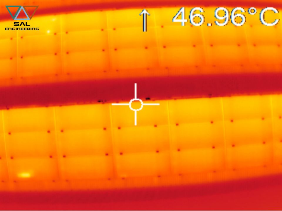
SAL Engineering designs and manufactures integrated systems for aerial thermal investigations of structures, electricity production plants, industrial plants, public buildings. The system consists of ...
SAL Engineering designs and manufactures video acquisition systems to conduct inspections, for research and rescue activities, to plan photogrammetric surveys, to have visibility of otherwise inaccess...
2015 - 2024 © SAL Engineering S.r.l.