SAL Engineering designs and manufactures integrated remote sensing systems, offers services of data acquisition, processing and editing of geo-referenced mapping products.
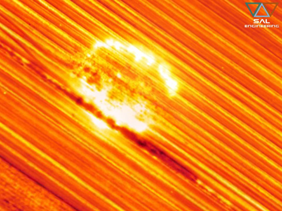
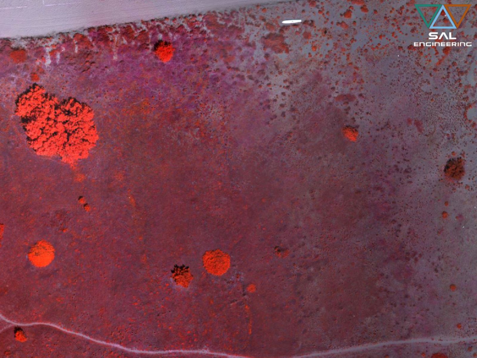
Remote sensing techniques include all data acquisition methods of the Earth's surface, based on the measurement of the electromagnetic energy emitted, reflected or transmitted by the different objects and phenomena investigated, followed by representation and interpretation. The amount of reflected energy varies according to the light source, the physical characteristics, the geometry and the chemical composition of the surface investigated; thanks to these differences it is possible to identify the different objects. The spectral signature of the various elements is important for defining the analysis intervals, in order to identify each element and investigate anomalies. In vegetation studies, spectral signatures can be used to evaluate plant health and their evolutionary state. For example, water has a lower reflectance than chlorophyll, which is characterized by a marked absorption in the red range, and a high reflection in the near infrared.
The aircrafts designed by SAL Engineering are equipped with a special stabilized gimbal that allows to equip multispectral and hyperspectral sensors. Data acquisition is carried out following a rigorous methodology, which takes into account the calibration of the sensor with respect to the incident light conditions at the time of acquisition. The survey is always planned in the laboratory before going in the field, in order to get a proper geometry of the acquisition plans, to fly in the most suitable time, to adjust the acquisition parameters (exposure time, acquisition rate), to plan the GNSS survey useful for precise georeferencing of models. The integration of the acquisition system with the inertial platform of the aircraft and with the GNSS positioning system is crucial because these parameters allow to know the orientation and the position of each individual shot.
The photogrammetric processing is carried out using specific software that use the Structure from Motion and Bundle Adjustment algorithms for the creation of the 3D model, while the processing of the radiometric data is carried out using proprietary software that allows extracting the actual photograms to each individual spectral band with the correct radiometric values.
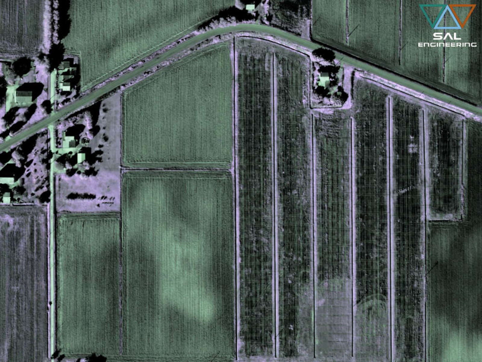
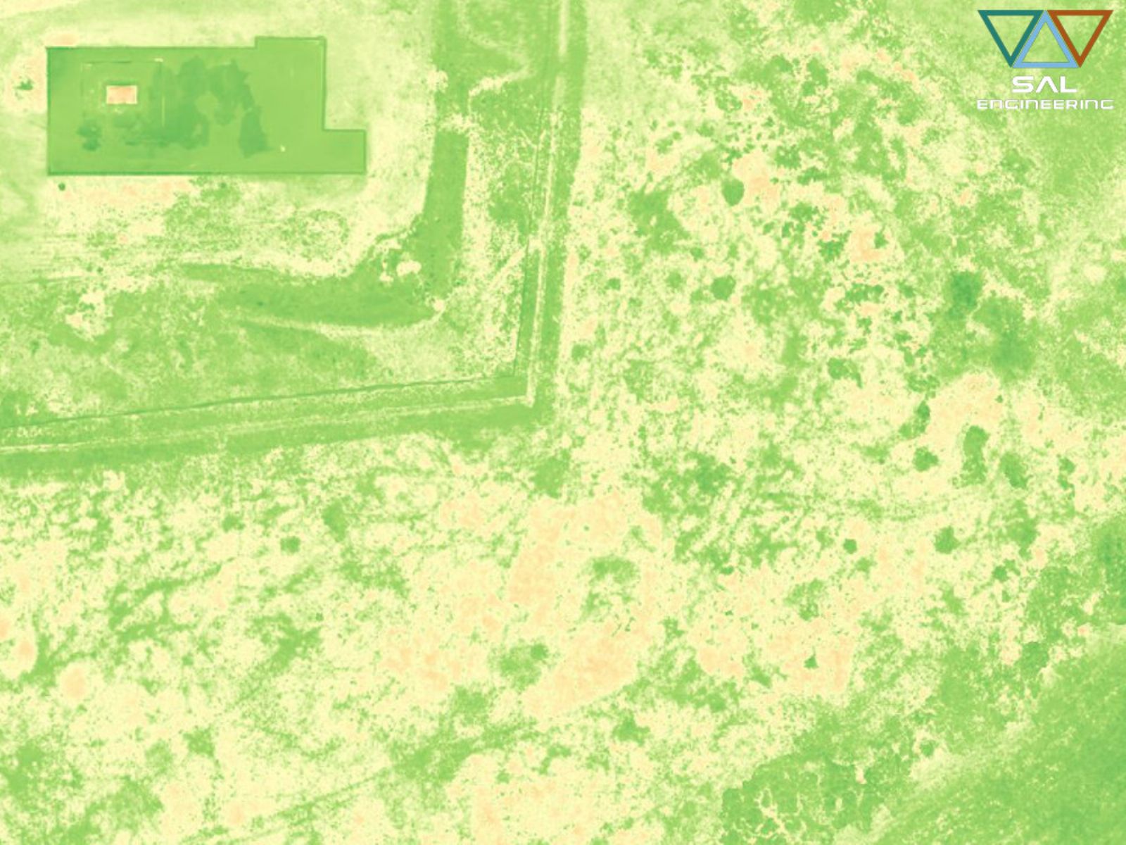
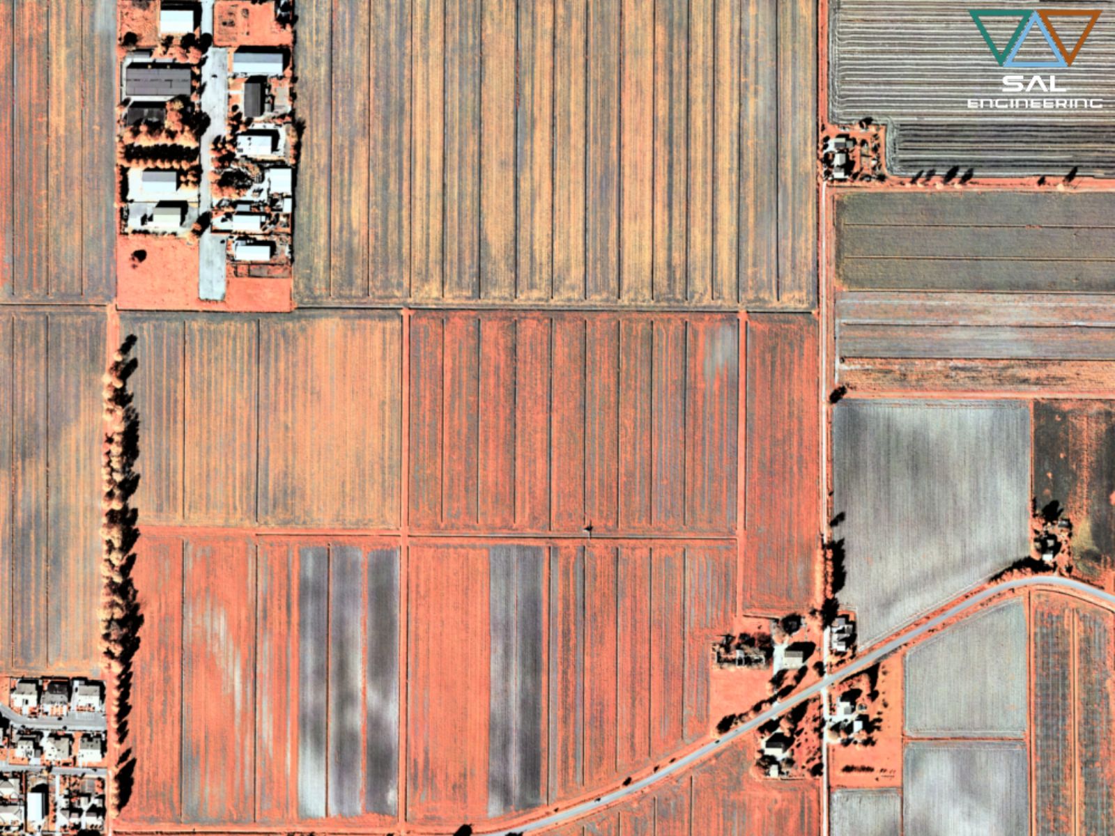
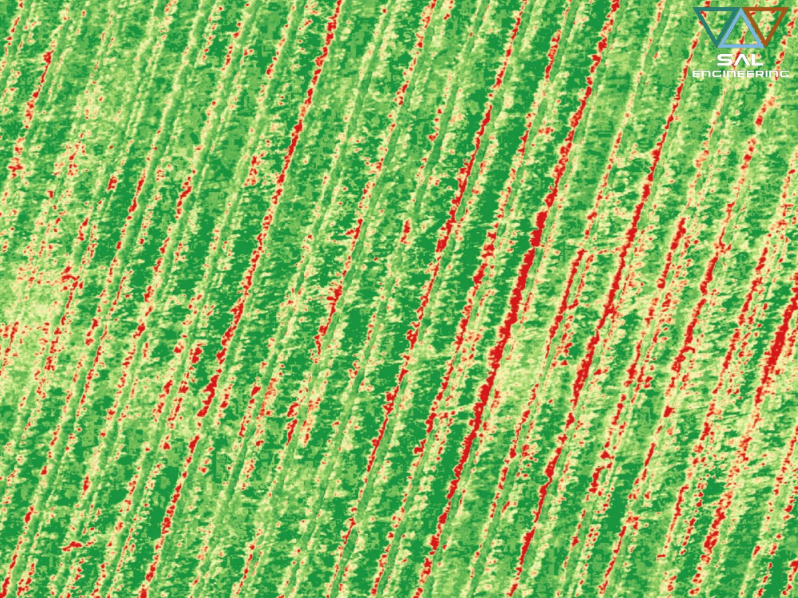
The multispectral survey is a very powerful means of creating digital maps in the service of precision agriculture, and results in a specialized approach aimed at optimizing the production system thanks to greater efficiency and a lower environmental impact. With this technique it becomes possible to classify the crops, calculate the expected average yields, monitor the nutritional status for the management of the fertilization activity, monitor the water stress for irrigation management, monitor the status of infestation for the controlled management of weeding, and monitor the health status of crops. The operations between bands allow to study the phenomena by indexing; for example, as regards agricultural studies, some indices such as NDVI, GNDVI and SAVI can highlight the state of health of vegetation.
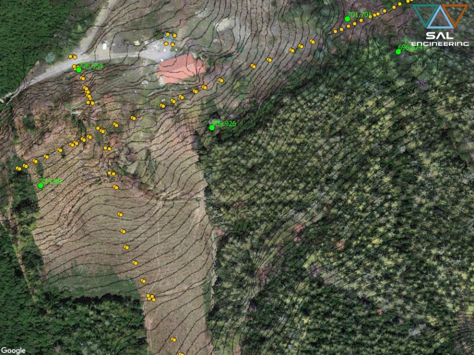
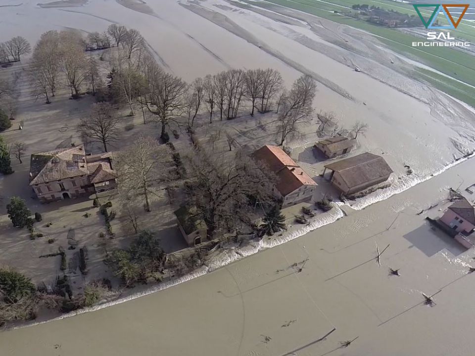
In the field of environmental monitoring, remote sensing techniques allow to identify the chemical-physical alterations of terrains and waters in order to identify and map any disperse polluting materials or surface erosion in the context of hydrogeological instability. Furthermore, multi-temporal analysis are extremely important for forestry monitoring, for the prevention of fire risk or for the analysis of ecosystem health.
The research and development department within SAL Engineering, constantly involved in laboratory research, design and optimization of metodology, has designed MAIA, the 9-band multispectral camera that can be installed on UAV, coupled to a radiometric correction system based on the measurement of the incident light at the time of every single acquisition. Three versions have been developed: MAIA WV has the bands corresponding to the DigitalGlobe satellite WorldView-2; MAIA S2 has the same band ranges as the Sentinel-2 satellite, which provides free satellite images according to the European Space Agency's environmental monitoring project called Copernicus; MAIA M2 is the latest modular version that the user can customize by choosing their own filters within a very wide set that covers the visible and near infrared spectrum.
Contact us for more information on Having Our activities, our products and services
Click hereSAL Engineering designs and manufactures integrated systems for photogrammetric surveys of land in the field of hydrogeological instability, protection of the territory, hydrogeological prevention, pl...
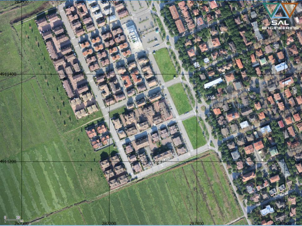
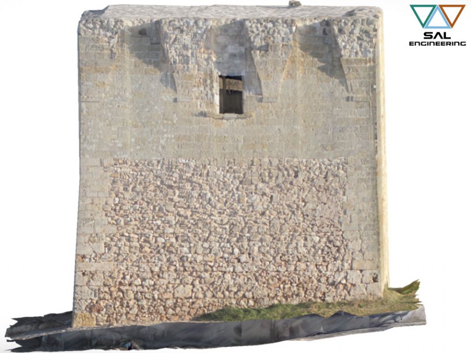
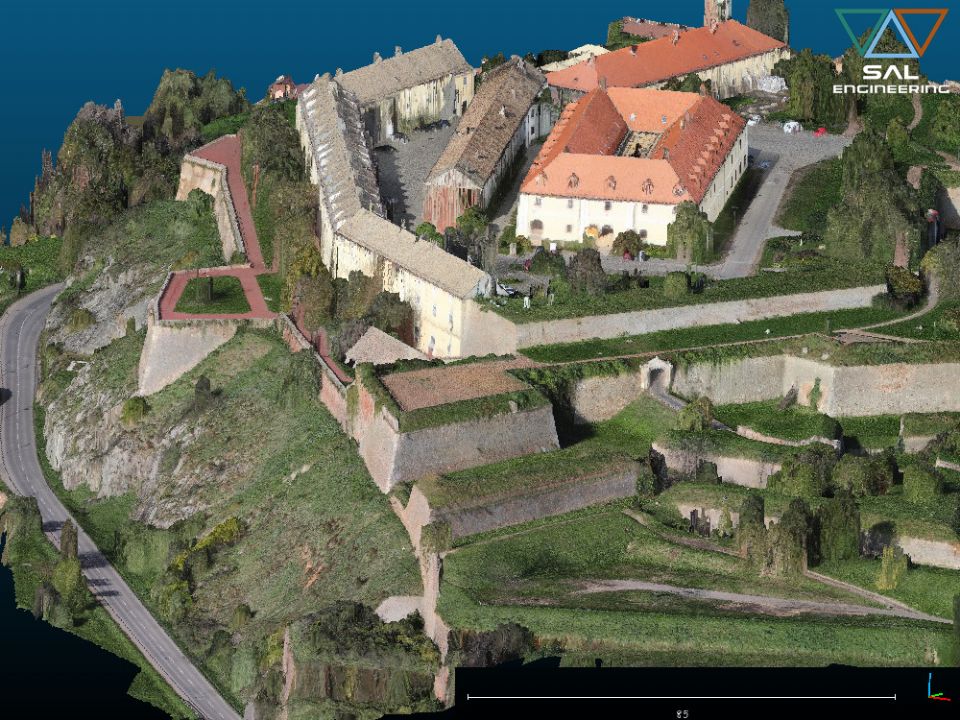
SAL Engineering designs and manufactures integrated systems for photogrammetric surveys aimed at creating 3D models with high precision and accuracy of buildings, industrial plants, quarries, dumps, c...
SAL Engineering provides aerial and terrestrial photogrammetric surveys aimed at the three-dimensional reconstruction of terrains, structures, pylons, towers, archaeological sites, antennas, ruins, ro...
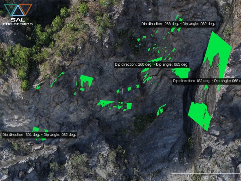
SAL Engineering has developed a method of digital analysis and survey of the discontinuities of the cliffs and rock formations directly on the point cloud obtained through photogrammetric survey, repl...
SAL Engineering has professional instruments such as dual frequency satellite receivers, high performance GNSS antennas, high precision total stations, high precision levels and high skills for the re...
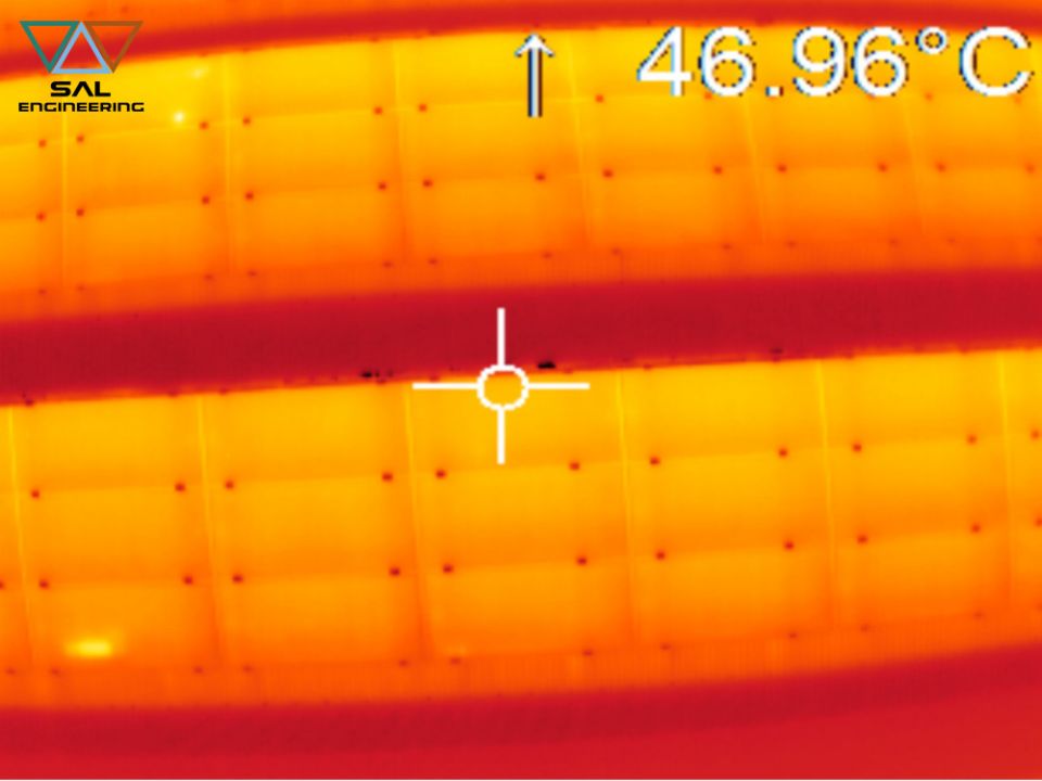
SAL Engineering designs and produces integrated systems for thermographic surveys aimed at mapping the surface temperature of terrains and any other surface. The system consists of a remotely piloted ...
SAL Engineering designs and manufactures integrated systems for aerial thermal investigations of structures, electricity production plants, industrial plants, public buildings. The system consists of ...
SAL Engineering designs and manufactures video acquisition systems to conduct inspections, for research and rescue activities, to plan photogrammetric surveys, to have visibility of otherwise inaccess...
2015 - 2024 © SAL Engineering S.r.l.